Nemecek’s New Star Trek Stellar Cartography Book
2 min read
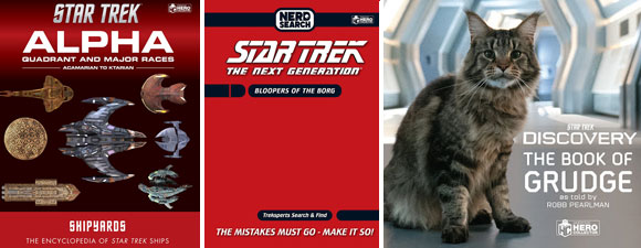
A new book from Larry Nemecek will be of interest to Trek fans who have an interest in cartography.
Star Trek Stellar Cartography: The Starfleet Reference Library will debut in December.
In Star Trek Stellar Cartography: The Starfleet Reference Library,” beautifully reproduced maps provide a rare opportunity to view the expanse of Federation space (and beyond) through the multiple lenses of the Galaxy’s key players—visually expanding the Star Trek universe in never-before-seen ways.”
The book was compiled by Star Trek expert Larry Nemecek, and was illustrated by Ian Fullwood, Ali Rees and Geoffrey Mandel.
Some of the ten large-format maps in the book include: “an ancient Vulcan map, a Klingon Empire map from the pre-Organian Peace Treaty era (in the native Klingon), an official Romulan government map of the Empire, a native Cardassian Union map from the occupied-Bajor era, along with Federation maps from the modern era.”
“I do not know what is cooler,” said Nemecek, “that we finally got to do evolved-canon star map posters suitable for framing, that we got to do starmaps from not only various historical eras but from various alien origins … or that I got to update and ‘massage’ some background gaps that have bugged canon fans like me for years.”
Star Trek Stellar Cartography: The Starfleet Reference Library, forty-eight pages in length, comes in a tri-fold clamshell case. The ten 24″ by 36″ maps are removable.
To pre-order Star Trek Stellar Cartography: The Starfleet Reference Library, which sells for $47.99, head to the link located here.



Considering his association with Star Trek Continues and the lying, thieving ‘magpies’ behind that production, I have NO intention of purchasing this whatsoever.
What is your beef with the fan based Star Trek: Continues?
There’s a guy in the production that he hates. He apparently stole another production’s film and posted it before it was complete… probably a total douche, but the guy isn’t the one in charge at ST:C… but, because he is involved, this guy can’t drop it. He’s not wrong that people should avoid the guy in question, but he is wrong to shit on everyone else trying to do this, which only hurts ST, just to get at that one guy… at least that’s how I feel about it. Blue Thunder can often have “Polaris”ing opinions.
Even more negative BS, dogpoo.
The guy asked what his problem with Star Trek: Continues is… He’s publicly stated his reason before, I just repeated it… I don’t see how I’m being negative… but okay.
That book should have been 47 pages in length. But at least the price has the right number – 47.99 🙂
I think I missed the joke… Why 47 instead of 48 pages?
You forgot to mention the fact that Vic Mignogna also stole from another Star Trek production just to fulfill his twisted and petty form of revenge against the professionals at P2. Anybody who is a part of Star Trek Continues is just tarnishing and ruining their reputation just by being a part of it.
Loosely translated, the Farragut Films people are in bed with a skunk(i.e. a criminal – Vic Mignogna)and the stink is really going to stick with them.
You’re kidding, right?!
Uh, no. It’s entirely possible it’s obvious, but I wouldn’t have asked if I wasn’t serious.
I don’t see how I missed that, given the second sentence of my first response… but whatever.
I’ll sound a bit like Bones when I say this: Dammit, Mike, you should know it, you’re a trek fan! 🙂
I find it hard to believe that you’re not aware of the 47 joke. But in the case that’s really so, here it is:
http://en.memory-alpha.org/wiki/47
Whenever I come across the no. 47 in any other show or movie it always makes me wonder: did they do that on purpose?
Weird, wild stuff… I did not know that.
Perhaps should have been more specific. He and the FF people also stole from the Starship Ajax production as well. They hijacked quite afew sets that they built for Ajax, and then took off with them. It was also vic getting back at the Johnson brothers for not selling him the starship Exeter set. The set had already been sold to the Ajax production and Vic Mignogna threw a childish fit about losing the Exeter sets to Ajax.
Another reason to boycott FF, STC and anything else related to Vic.
*For the record, this pic, like many others, that were created in photoshop are no different than the political/social cartoons that the public reads in the newspaper. They are meant to address the political and social commentary in the Star Trek fan community.
Starship Farragut’s home page had the following message for all to see: The number 1 home for Star Trek Fan Films – Welcome to Starship Farragut.
Yeah, right!
More like the number 1 home for high school-clique mentalities who started out as something cool and then later became a ‘gated community of the damned with segregationist tendencies'(Dennis Russell Bailey’s own words – not mine), all because they became involved with an unethical and controversial business partner, who has a very questionable background.
In the 1992 Star Trek graphic comic book Debt Of Honor, the U.S.S. Farragut, NCC-1647(after its fateful encounter with the Tycho IV entity that cost the lives of half its crew and its captain), met its fiery end at the hands of another hostile alien life force.
In late 2011, the Starship Farragut production made fan headlines after becoming embroiled in a controversy over the ‘supposed’ illegal seizure of the Starship Ajax production’s film sets in Oklohoma City.
In early spring of 2012, the Starship Farragut production once again found itself in the middle of a heated controversy. One involving the unethical and highly questionable acts of its new business partner, concerning the partner’s illegal ownership, witholding, and unauthorized broadcast of the Star Trek-New Voyages/Phase 2 episode ‘Kitumba’.
After the surrounding controversies concerning Farragut Films, its integrity, its now-tarnished
reputation, and its questionable business relations within Star Trek fandom and its less than honest dealings(treatment)with people(what do you expect from a Washington D.C. based film company), one hopes that a science fiction writer will adapt the aforementioned storyline subplot from the 1992 DC Graphic Novel, and modify it into the final episode of Starship Farragut, itself. Thus bringing an end to this fan film series(i.e. like Blake’s 7’s finale)from further poisoning the Star Trek fan realm with such illogial, disgraceful, shameful, negative, and disgusting emotionalism.
http://trekmovie.com/2012/03/26/new-star-trek-fan-film-to-feature-chris-doohan-as-scotty-and-mythbusters-imahara-as-sulu/#comment-4656857
http://www.trekbbs.com/showthread.php?p=6187033#post6187033
http://www.trekbbs.com/showthread.php?t=169732
http://www.facebook.com/startrekphase2/posts/10150828754860934
http://trekbbs.com/showthread.php?p=5440252#post5440252
So, I don’t have a stake in this… but just one question: If he’s going around stealing things, from the actual production to sets, why hasn’t he been arrested or sued? I mean, accusations aside, where the rubber meets the road, has anything happened against him? And, if not, why not?
Believe me, Mike, I have been asking the same questions, myself. My guess is that Vic(being a former policeman)knows the ins and outs of the system, and has somehow been able to stay one step ahead of the system. There is also the possibility that he has other connections, aside from Farragut Films. There has been an unconfirmed rumor that Farragut Films paid off the Starship Ajax production(the production that Vic and certain FF members)robbed from, just to prevent them from pressing charges. Whether that rumor is factual or not, I do not know. Given Farragut Films’ controversial history since this incident was revealed in November of 2011, I’m willing to bet that it is factual.
I spoke with one of the main production staff of Starship Ajax and here is what he had revealed. For reasons of confidentiality, his name will not be revealed. He explained in detail what happened, and how Vic and Farragut Films
set that production behind by a year.
“Ok…here’s the whole STARSHIP AJAX story….We had just aquired the bridge set
from another production; “Starship Exeter”, and had moved it to an airplane
hangar to begin restoration. It had sat in a polebarn for several years, exposed
to the weather, so it was in pretty rough shape. Vic had attempted to get his
hands on it, but showed up 2 weeks late, so the owner, Jimm Johnson gave it to
us.. When Vic heard that it was about to slip through his fingers, he hustled to
Texas to get it. (You see, he wanted it to make his production, “Star Trek
Continues”) Jimm told him, “Sorry pal, you never showed up. You snooze, you
lose!” Vic was furious and threw a hissy fit…offered thousands of dollars for
it…but Jimm’s mind was made up; the bridge was ours to keep. Vic then set about
badgering us to get it…rent it…borrow it…He waved around his checkbook and that
got the attention of the AJAX team. I wasn’t there for any of this, but I was
getting constant calls from the guys to keep me in the loop. I’ve worked with
types like Vic before, so I tried to warn the guys…told them to steer clear of
this guy…he was just a bad news Hollywood type who will tell you what you want
to hear, but screw you in the end. Finally, a deal was worked out that Vic would
rent the hangar next to ours, help with our rent and send a crew to help us
build all the other sets (Conference room, captain’s quarters, curved corridor,
transporter room, sickbay) and an exchange would be made…Vic would get to shoot
on our bridge, and we would get to shoot on the new sets. Now, keep in mind,
restoration stopped on our bridge to do this and rent was still being paid for
the space while our bridge just sat there. For a month or so, the work on the
sets progressed and things were looking great. We were so stoked that we would
actually have all the original Star Trek sets at our disposal…and THAT was when
Vic yanked the rug right out from under us. He showed up late one night with a
crew, packed up all his sets and left. He probably would have taken the bridge
too if he’d had a key to our hangar. At this point, we had used up all of our
building materials, our budget was shot, and to make matters worse, he stuck us
for the rent. His final words? “Payback is a bitch.” His B.S. set us back over a
year as we crawled out of the hole that Vic dug for us. He brought the whole
mess to the folks who make “Starship Farragut”, making the same promise to them.
You see, he got free labor and materials out of us and basically ruined us…all
because we beat him to the bridge that he wanted. Do I HATE this vindictive
a**hole? Yep….”
Furthur information about this incident can be also found at the following website links. Plus the information on Vic’s illegal release of Star Trek – Phase 2 ‘Kitumba’ about a year past. The latter incident being a violation of a C and D order from what was revealed. Hopefully, they are still available for access.
http://www.trekbbs.com/showthread.php?p=5440252
http://www.trekbbs.com/showthread.php?p=5440252
http://www.trekbbs.com/showthread.php?p=6187033#post6187033
Vic has also been banned from various conventions for other illegal activities(one in particular of a carnal and underage nature). As to why he hasn’t been arrested for those activities, it is only because nobody has stepped forward with an concrete evidence regarding that specific issue. The evidence is out there. Somebody just has to step up and bring out into the open.
While on the subject of Vic’s controversial nature, here is some more evidence.
For those who have been wondering about the incident concerning Vic’s attempted coup of Phase 2 some years past, a production member on that fan film also revealed and confirmed this. As with the Starship Ajax production member, the name of this person is being respectfully withheld.
“So here is a “minor” tale from the Phase II side. For the episode being shot
June 2011, James was set to play Captain Kirk’s father – as Kirk himself barely
appeared in the episode. Vic begged and begged to have the part, and offered a
friend to play another key role “Guy #1″ and James turned it over to him. Two
weeks before filming was to begin, the actor for “Guy #1″ got a paying gig and
bowed out. Therefore, we switched it back to James playing Daddy Kirk and put
Vic playing “Guy #1″.
Vic called me. Sobbing. And I mean SOBBING. And BEGGING to play Daddy Kirk,
saying it was his “only chance, ever, to play a Kirk”. When I told him we had no
choice, he asked if HE could find someone to play the “Guy #1″ role. James told
me to tell him he could try, but at this point in time we couldn’t help with
transportation, lodging, or anything else a “real actor” might want. He called
us later (not sure how many days) and had roped Colin Cunningham into it. Vic
said Colin was available the entire two weeks and that Vic would pay the salary,
food, lodging and transportation Colin wanted for working. James told Vic that
if he was willing to do all that then, of course, he could play Daddy Kirk and
we’d love to have Colin for the other role…as long as Vic understood we were not
paying for ANYTHING.
So I call Colin to set up his lodging. It is then I find out that he is
available for two days at the beginning of the shoot and two days in the middle,
but had to go to Canada in the middle and at the end. NOT the entire shoot. (As
he was a main character, and other stuff had to be scheduled in, we could not
schedule around that.) I tell James and then call Vic to report the problem. Vic
then yells at me for 10 minutes that it’s completely unnecessary for Colin to be
there the entire time and I am causing trouble by having told James that because
“he doesn’t need to be bothered with those kinds of details”. Vic then calls
James and tells him I am lying and Colin is available the entire shoot. Vic then
calls me back and yells some more about me telling James to begin with. (In case
you guys don’t know, James is the creator and Senior Exec of our production…or
HIS production LOL) I tell Vic I can’t schedule the guy for 4 days and we’ll
just have to go back to James playing Daddy Kirk and Vic playing the other guy,
and we need to thank Colin for his willingness to try to work with us.
O.M.G. Vic melts down completely. First yelling at me that “James can barely
handle Captain Kirk, there’s no way in hell he could handle the other Kirk”.
Then he sobs and begs some more. Then he goes back to saying James can’t act his
way out of a paper bag. Vic insists we can film a heck of a lot more in 4 days
than we are able to. Vic accusses me of causing trouble by telling James the
truth and “upsetting him with a truth he doesn’t need to know. It’s better if
James is ignorant of the details of his production.” Vic then calls James and
tells him that yes, Colin is available the entire shoot and he doesn’t know why
I am causing trouble and telling James otherwise. In fact, he says James should
get rid of me for causing such trouble.
These calls to James and I, back to back, go on for about 45 minutes.
Oh. I forgot to mention…..while he is calling James saying one thing, and
then calling me yelling cause I told him the truth…..wait for it…
James and I are sitting next to each other at a restaurant. It would have
been funny as hell if it wasn’t so infuriating.
Long story short… Colin comes. Vic does pay his expenses. He is not available
the middle days and expects us to provide transportation to Canada and back for
him. When he finds out we don’t have the money or driver to do so, he stays in
his room, refusing to come to the set during those days because Vic only is
paying him for the 4 days. (Colin was an absolute professional and a joy to work
with, btw. I am just pointing out Vic did not pay him for the entire shoot, as
he agreed to do.) Vic and his business partner who attended made this shoot
sheer hell – which is ENTIRELY different from our “fun summer camp” we are used
to. Not surprisingly, we did not get all the footage we need to finish this
episode. (We’re still working on pickups)
But here is the kicker- to this very day, Vic claims that James “stole” his
money and “owes” Vic the money he paid Colin and for Colin’s requirements.
Folks, I was involved every step of the way with these arrangements, even
listening in on speaker phone when Vic was talking to James, and I can ASSURE
YOU that Vic absolutely agreed to pay everything needed and understood
absolutely that there was no way in hell that WE or James could ever pay it, nor
would we. But Vic states this as his #1 reason for “hating” James and trying to
bring the production down.
And, that, folks, is just the tip of the iceberg…..
When James finally started screaming “hang the **** up on him! Hang up! HANG
UP!” and then did it for me….I finally texted Vic “speaker phones suck, huh?”
LOL and, yeah, this was the issue that Vic used to try to get his edit
seen…”
This is not an exaggeration. From what I have heard there is SO much more.
However, I have not been privy to the rest of the information concerning this.
Suffice to say, Vic brings a path of destruction with everything he “works”
on…”
Loosely translated, he is known as The Doomsday Machine of Star Trek fan films.
This P2 staff member had also mentioned about some rude and crude, if not juvenille messages that both John Broughton and Michael Bednar had also made, concerning certain members of Phase 2. The result of that foolishness led to the Phase 2 production’s lawyer sending a C and D order to both Broughton and Bednar.
I have not seen or read that particular information, but, having dealt with such behavior from Broughton and Bednar before, I believe that information to be quite factual.
For some people who claim to embrace the 23rd Century values of Star Trek, they certainly act with the same primitive mentalities of the 21st Century.
Not a cool thing in my book….
The links that I posted below should answer your questions, as well as the other posts.
Thanks Blue.
IF what is being alleged is accurate, yeah, you paint a pretty dim picture of this fellow.
BUT you go out of your way to specifically address him by name and accuse him of all these thing all the while, the accusers are unwilling to have their names attached to the “truth”.
SO, I’m not overly impressed with the evidence.
DO I believe you? I believe you believe it.
DO I believe you’re wrong? I don’t know if you’re right or wrong, but I know it’s not right for me to condemn the man based on your word, which isn’t really even your word, it’s the word of an anonymous set of sources.
IF Vic Mignogna did the things you say, obviously he should be dealt with… But the things he is doing aren’t trustworthy from secret sources.
And that’s been my position all along. I don’t like the stink this guy is leaving on ST fan productions, but at the same time, I’ve never seen any actual evidence, beyond negative lip service from not exactly credible sources, to actually implicate him.
If he stole from these productions, why are these productions unwilling to tell the truth? Because they’d be sued for slander? Well, that’s easy… the best defense against slander is the truth… If it’s the truth, they cannot be successfully sued… So…
On the contrary, since you can produce no one who will go on record accusing this man of anything, all we see are some anonymous internet handle using anonymous internet quotes to do real, serious, lasting damage to someone that isn’t anonymous, but is absolutely the target of this ire…
If these things were done, he should be held accountable. He will not be held accountable via this means. If you really want to make a difference, get people to attach their names to these accusations, or they’re worth no more than the pixels that convey the information.
My pleasure, uzimodem
I’ll definitely ask my sources and request permission to have their names attached to their accusations. if they say yes, I will add them. If they say no, then i will have to respect their wishes in the matter.
It’s all I can do.
It would certainly be more credible. I mean, you can see why I’m not willing to just kneejerk react to this, right?
Another question: If he was being that much of a douchebag, why did James Cawley continue to work with him? By your own account, by the time that other guy showed up, a fiasco had already transpired for it to happen… including a phone call Cawley was allegedly there for, wherein Vic Mignogna was trashing him, his acting, etc… So… why didn’t they just tell him to take a hike then? What was it that he was providing to P2 that made them put up with that?
Something about this seems very weird to me… Maybe if the people that know the truth would just be open with it… I mean… if these people think that VM is that bad of a guy, what is the motive for keeping his malfeasance a secret? Or their observation a secret?
There’s a piece to this puzzle still missing, and not just the actual attributions to those quotations.
I wish I knew. Unfortunately, there hasn’t been any information made available concerning those details.
From what I was told, that incident involving either the phone call or what happened involving Colin Cunningham was the final straw that broke the camel’s back. This is just speculation on my part, but if I understand the situation correctly, the P2 staff was trying to get the Kitumba production wrapped up, as well as the production work on The Protracted Man(aka Origins).
As a result of Vic’s hinderance and other toxic, narcicisstic BS, he was finally banned from the P2 set.
Maybe this missing piece might help.
http://trekbbs.com/showthread.php?t=133657&page=53
1. That link contains quotes from the following people on Line # 793 and 795 from Jim The Builder of Ajax and Loken(Alec Peters)of the recently bankrupt company Propworx. Loken is also an archivist for CBS Paramount concerning the history of Star Trek. He hates Vic’s guts and Farragut’s just as well.
http://www.trekbbs.com/showthread.php?t=133657&page=54
2. On the other link, Robert Simmons(Family Dog)on #796 also explains what happened. He was a former producer of Ajax before he left, due to Vic’s actions. Vic was the cause of his resignation.
3. #797 and 807 are also more explainations by Alec Peters, concerning the matter.
http://trekmovie.com/2012/03/26/new-star-trek-fan-film-to-feature-chris-doohan-as-scotty-and-mythbusters-imahara-as-sulu/
4. From #29 on down there are more postings made by Alec Peters and Jim The Builder(Jim Bray). In a couple of posts(for reasons I still find unusual, let alone are unknown)Loken either retracts his statement or phrases it differently concerning what happened with the Ajax property. Jim The Builder also does that too, at first. But later, he explains what really happened when he was there. Rumor has it that Farragut Films may have paid reperations(i.e. hush money)to Ajax just to keep them quiet and prevent the situation from going legal. I can’t confirm that part, but it does sound quite suspicious and typical of Vic’s character. It is also here that both Alec Peters and Patty Wright reveal the other incident involving Vic concerning his theft and withholding of the raw footage and illegal release of said footage concerning the Phase 2 episode ‘Kitumba’. One that Vic directed and guest starred in along with his squeeze Michelle Specht.
I should also point out that the Kitumba incident and quite possibly the time that the upcoming Phase 2 episode The Protracted Man(i.e. Origins)was also where Vic made an unsuccessful attempt to take over P2 from James Cawley. This may have also something to do with dispute over which film company had the
rights to film the episode ‘Mind-Sifter’.
http://trekmovie.com/2013/05/30/fan-production-star-trek-continues-releases-first-episode/
5. There are quite a number of disputes on this thread by many, concerning Vic. After the post I made at 559, it gets real interesting. At # 631, I refer to a post where Jim The Builder would later explain what really transpired. At #632, I refer to an incident that Patty Wright also posted about, concerning Vic’s toxic BS and Farragut Films involvement of the theft of Ajax’s property.
From what I was told, there’s more where that came from. However, some of that information has not been revealed. As one P2 insider stated, ‘there could be whole book written about it.’
Hope this information will help.
This entire thing is a load of baloney, Alec (and yes, you are either Alec or someone who works for him). The idea that “anyone associated with STC is tarnishing their reputation” is a joke. More like the other way around. You guys are pathetic losers and will never — and I mean NEVER — get your project off the ground. Either grow a set of balls, disclose your name, and press “charges” against Vic (LOL!) in a civil or criminal court and see how much they stick… or go sulk away with your tails between your legs like the pathetic amateurs you are.